Mt. Whitney Mountaineer's Route, November 2014
Having not climbed anything in half a year (longer for my buddy Anthony) we decided it was time to get out of town and into the mountains. We originally were shooting for North Peak Couloir but when we found out that Tioga Pass was closed I knew immediately where we had to go--Mt. Whitney.
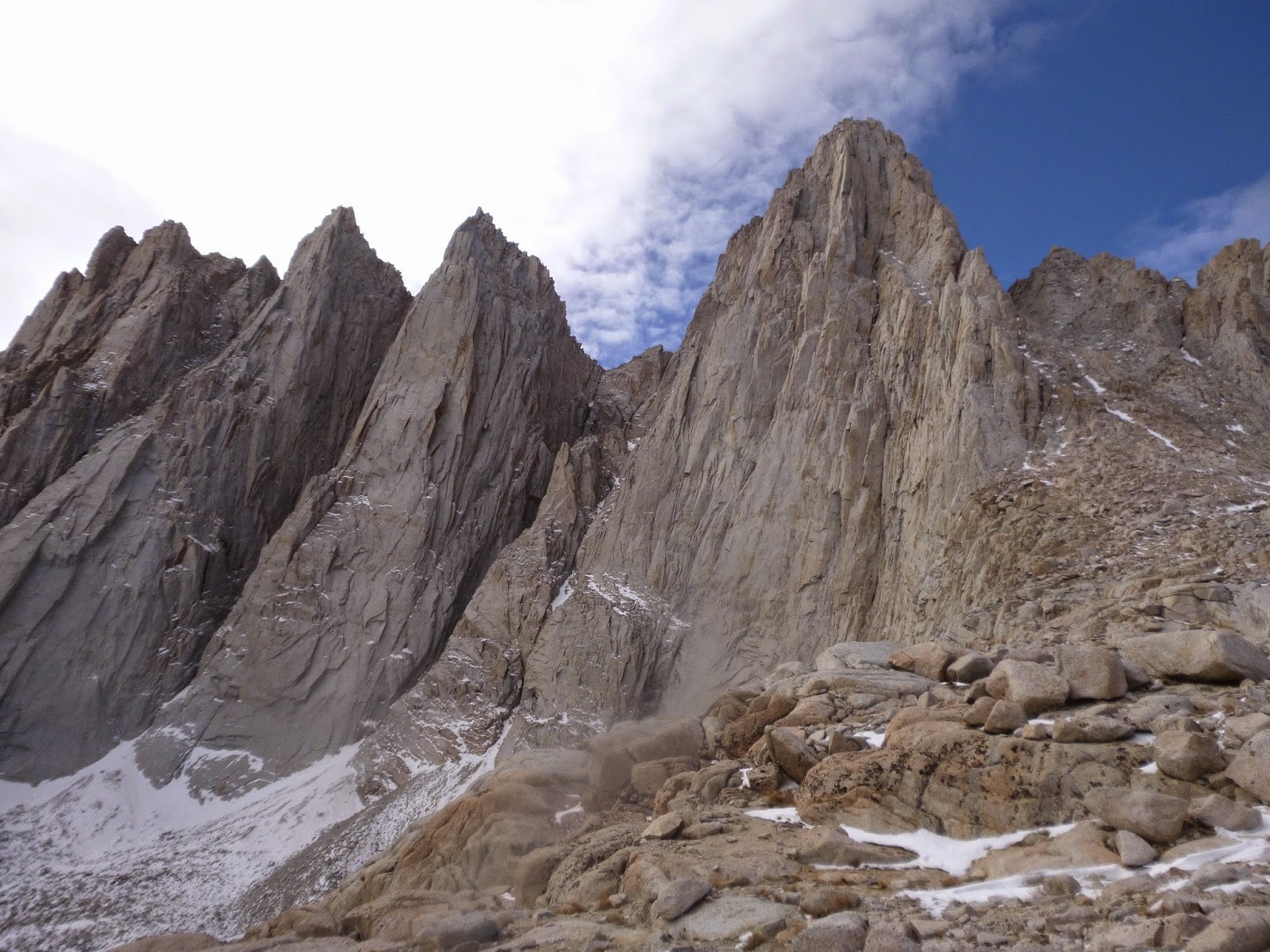
Mt. Whitney Massif from the Ranger Station parking lot

We had unfinished business on Mt. Whitney after our first trip last year ago ended up being a complete cluster*uck. Unable to find the E-Ledges, we wound up bushwhacking up and to the left of the major drainage that take climbers to Upper Boyscout Lake (instead of the correct way toward the right) and when darkness set in we used pocket knives and ice hammers to chop down tree branches and make a bed on an exposed piece of granite with a nice view of the mountain we knew we had driven 6 hours for, and were determined to not reach.
To put the cherry on top, when we got back to the car the next day I found out I had left the headlights on in the Subaru, and we had to call a tow truck for a jump, and then buy a new car battery to the tune of $300.
This was me in full defeat mode circa 2013...

Mt. Whitney Mountaineers Route (as the sign says) is a very difficult route to follow. There is not really an obvious trail. The place is littered with cairns however. Cairns are stacks of rocks that people make to indicate a route. The trouble is you never know what they mean, who put them there, how long ago, or where do they lead to. They were everywhere!

After our route-finding failure in 2013 I knew to come prepared, so in addition to a topo map and compass, I mapped out a course I felt accurate on my Suunto Ambit 3 GPS, and we relied heavily on it this trip to find our way to the E-ledges (and were largely successful in not getting lost.)
The Ebersbacher Ledges (E-ledges) are a large 5th class granite face with a hidden 3rd class route up it. As it turns out it is fairly easy to navigate in the daytime. The trip down it at night after summiting was a different story--more on that later.
Me taking a rest on the trail leading to the Ebersbacher Ledges

After passing the E-Ledges we followed a natural footpath to Lower Boyscout Lake, stopped and had a GU and some water, then continued to where the trail stopped, and did the dance onto a snow-covered talus field that led us to long low-angle slabs covered in soft ice. The kind of ice where you can hear (and in some places see) water flowing beneath it. We knew we had to cross it to get to our intended camp, so we threw the crampons on, hoofed it across, and made our way up to Upper Boyscout Lake at 11,300ft where we camped for the night.
Ice slabs below Upper Boyscout Lake

Anthony and I did our usual plan for 14ers, and it has consistently worked well. We climb as high as we can the first day (usually 10 or 11k feet), then spend a day at altitude hydrating and acclimatizing, then summit and go home the 3rd day. Some significant weather moved in on our rest day. Winds gusting 60mps, with steady 30-40mph, blowing ice and snow. (I caught a piece in the eye). We didn't spend a lot of time outside the tent that day. I did manage to take a video on my cell phone of the weather.
After attempting sleep for many hours in the wind we got up at midnight, took the poles out of the tent and covered it with rocks so it didn't blow away, and left for the summit.

We ended up making better time than we anticipated to Icehouse lake at 12,500ft (near the start of the climb) and decided to wait an hour and a half to melt some snow to refill our water bottles, and then head up the couloir. Sitting there in the dark at 4am in below freezing temperatures not moving sucked. We were both cold. This is the first time that I've whipped out my emergency bivy to see if it helped at all. (turns out it doesn't do a whole lot) We boiled a nalgene each, put them in our parkas, and waited for the water to boil (which takes forever in the cold) before heading up the snow chute for the summit of Mt. Whitney.
Rod looking cold. Postal envelope contains snow we will drink

The Mountaineer's Route couloir up Mt. Whitney was the most garbage conditions I've ever climbed in the Sierra. It was a vast ocean of pebble sized scree covered in some places in powder you would post-hole in to your hip. This was the most un-fun grovel at 13,000-14,000ft I care to ever repeat. It took SO much longer than we anticipated because for every step up you took 2-3 steps back.

We witnessed Alpenglow from sun hit the rocks to the right of us, but we remained in the shade the whole way up until we topped out at 14,200ft on the ridge of Mt. Whitney. The sun felt incredible.

We were happy to finally be on top at about 9:30am and anxious to get back down. We had 4 Gu's left between us and 1 Nalgene each.

We made the painfully long shuffle-slide back down the couloir and to our tent at Upper Boyscout Lake to find that crows had eaten the last of our food and had diarrhea all over our living area. One of them was sitting there laughing at us as we packed everything up. We filled our nalgenes in a stream, threw some tabs in and hit the trail fast, as evening was approaching and we knew we had some challenging routefinding on the way back to the car
Looking back on Mt. Whitney (furthest right peak)
The way back down was SO much longer than we remembered, and it got dark just as we had to navigate the E-Ledges for the second time. Fortunately Anthony's memory and my GPS got us where we needed to be, and we made it down the drainage to the main trail, with both of our feet and ankles on fire from the abuse of the day. From there we weren't speaking, we were on autopilot in the dark powerwalking with headlamps on until we finally started hearing water, then passed the river by the the trail sign, and a few miles later, we finally arrived back into the parking lot at the car. We trashed the WAG bags, changed, drove back down into Lone Pine and smashed a burger and fries, and settled in for the 6 hour drive back home. I didn't get home until 2:30am, and I woke up at 1:30pm the next day and discovered I was so sore I couldn't walk right for four days. I love mountaineering...
Wow! This was fun? Great job but such hard work. Crow diarrhea sounds like the icing you didn't need on your trip. A lot of this sounds seriously dangerous...to me. Much better result than your 2013 trip!! Congrats!!
ReplyDeleteOvercoming so many obstacles and weather challenges must have made you both very happy to get back safe and sound.
ReplyDeleteWell done lads !
Thanks for the share. Congrats on a safe and no rescue summit. Good example set for wag bag packing out, remote auth for free Starbucks by me if at all interested.
ReplyDeleteFirst ascent of the mountaineers Route by John Muir on summit 8 A.M. October 21, 1873. Submitted by Steven Thaw, Moraga, California
ReplyDeleteSteven good call. If I remember correctly, he also approached from Lone Pine. Quite a hike!
ReplyDeleteGreat trip. How was the Amibit 3? Did you navigate back down using pre-programed waypoints? or, did you use the reverse route feature? I can't believe you were able to get a mailman to deliver you an envelope full of snow to melt up there!
ReplyDeleteScott the Ambit 3 was excellent. The GPS is very accurate and quick to locate. I navigated back down just by using pre-programmed waypoints. I charted the anticipated route on Movescount before I left. This trip reminded me not to solely rely on technology. It died on me and went into "watch-only" mode about an hour before we hit the car. I recommend bringing a solar charger if you are going to be using it intensively for more than 36 hours.
Delete